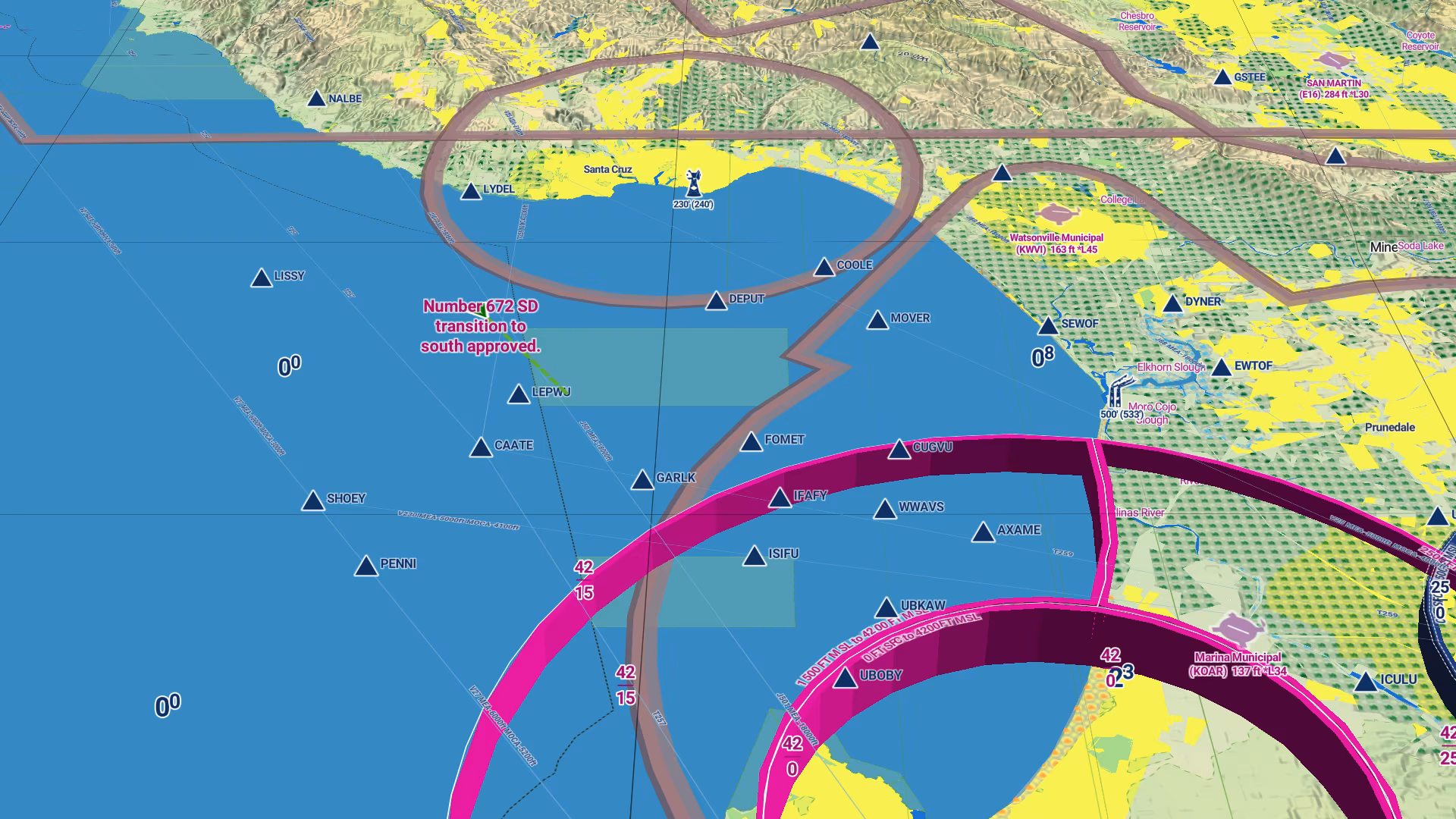
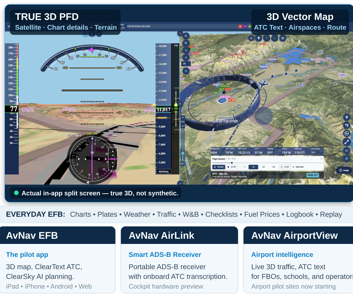
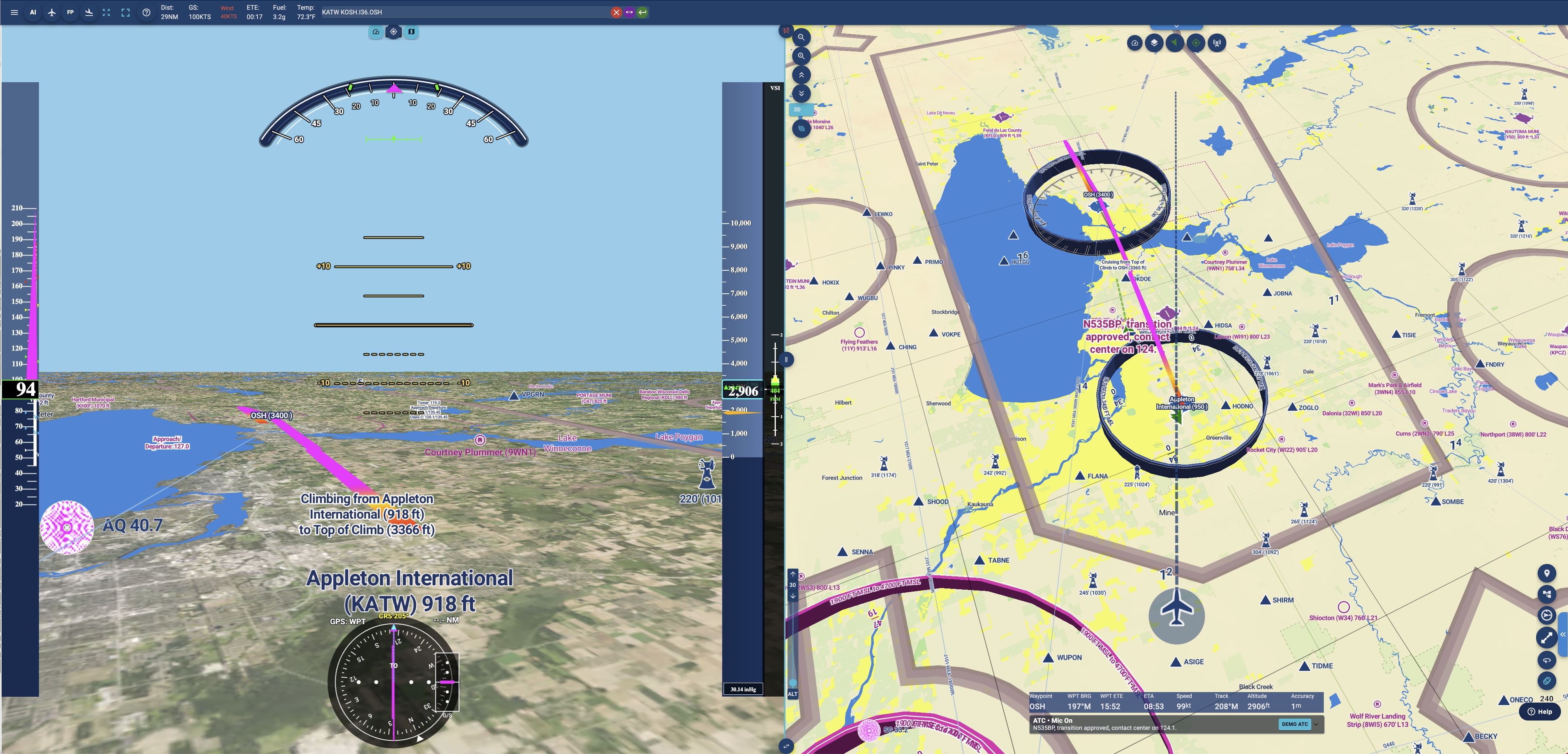
See AvNav at Oshkosh — Booth 3130C, Hangar C.

The Complete EFB for the 3D + AI Age

3D maps. Live ATC text. AI flight planning. Plus the full EFB: FAA charts, plates, weather, traffic, W&B, checklists, logbook, and replay. Now complete.

Plan with AI. Fly in 3D. Read ATC.
Log every flight — replay it in 3D.

Offline-first. Cockpit-ready.

Instant Launch: No App Required

Scan below to get AvNav on your device. 30-day free trial.
iPad · iPhone · Android · Web · macOS · Windows

QR code for AvNav on the App Store
iPhone / iPad
QR code for AvNav on Google Play
Android

Download AvNav for iPhone, iPad, or Android.

Download on the App Store Get it on Google Play

See AvNav in Action

3D map, live ATC text, AI planning, charts, plates, and replay in one 3D view.

Why AvNav Feels Different

AvNav starts with a complete EFB foundation, then adds a live 3D operating picture, readable ATC, and AI planning that help pilots connect what they see, hear, plan, fly, and review.

AvNav 3D aviation map with terrain, airspace, route, and traffic context

3D Aviation Map

AvNav renders airspace, terrain, traffic, routes, airports, and flight paths in real-time 3D over satellite imagery and aviation map. The PFD is tied into that same 3D pipeline, so the cockpit display is connected to real terrain, route geometry, and chart context rather than a separate synthetic-vision approximation.

ClearText ATC inside AvNav

Read ATC — Not Just Hear It

ClearText turns fast, noisy aviation radio into persistent cockpit text tied to aircraft and airport context. Radio calls no longer disappear the moment they are spoken.

ClearSky AI flight planning in AvNav

ClearSky AI Flight Planning

ClearSky AI helps pilots search practical flying windows over the next 12 days without manually comparing dozens of routes, dates, and departure times. It can evaluate route, weather, timing, and pilot preferences such as avoiding night flying and preferring weekend departures.

Instant Launch: No App Required

Scan below to get AvNav on your device. 30-day free trial.
iPad · iPhone · Android · Web · macOS · Windows

QR code for AvNav on the App Store
iPhone / iPad
QR code for AvNav on Google Play
Android

Download AvNav for iPhone, iPad, or Android.

Download on the App Store Get it on Google Play
Complete EFB Foundation

A complete EFB today — not a concept

AvNav is a credible everyday EFB. The current release includes the cockpit tools pilots expect, plus the 3D + AI layer that makes AvNav different.

Charts and plates in AvNav

Charts and plates

Familiar FAA Sectional/VFR chart views, IFR charts, airport diagrams, and geo-referenced approach plates for everyday flying.

ADS-B weather and traffic in AvNav

ADS-B Weather & traffic

ADSB Weather and traffic is displayed in the same 2D/3D view.

Aircraft performance profiles in AvNav

Aircraft performance profiles

Starter estimates for 700+ aircraft models, editable by the pilot.

Weight and balance CG graph in AvNav

Weight and balance

Model-based W&B with loading scenarios and CG graph for 400+ models.

Checklist support in AvNav

Checklists

Aircraft checklist support for cockpit workflow — more than 700 starter templates included.

Fuel prices for FBO planning in AvNav

Fuel prices

Fuel prices from more than 2,700 FBOs around the country.

X-Plane bridge controls in AvNav

X-Plane bridge

Connect AvNav to home-simulator flights for practice, demos, and repeatable testing.

Offline-first fast downloads in AvNav

Offline-first core: fast downloads

Designed for the cockpit, with modern image formats in mind. AvNav downloads are up to 4× smaller than typical EFB. Users can download all maps and charts for the entire U.S. in less than 5 minutes.

Familiar EFB Tools, Still There
FAA charts and geo-referenced plates in AvNav

Familiar FAA Charts and Geo-Referenced Plates

AvNav does not ask pilots to abandon the chart picture they already trust. The app delivers the full set of traditional EFB references — FAA-style Sectional/VFR charts, IFR enroute charts, airport diagrams, and geo-referenced instrument approach plates — and lets them sit beside the 3D map, PFD, and replay views when added context helps.

Keep a trusted sectional or plate visible, then compare it with 3D terrain, airspace, route, traffic, and replay context in the same workspace — the traditional EFB foundation and the 3D + AI layer, side by side.

Every Flight Becomes a 3D Debrief

AvNav records flights on-device and replays them through the same map and PFD pipeline used in flight — in 3D, with synchronized attitude and ATC text. Pilots can scrub, vary playback rate, and rotate around any moment. This turns every flight into a visual debrief for proficiency, instruction, and post-flight review.

AvNav 3D replay view with flight path and map context

A Real-Time Aviation Intelligence Platform

The same engine extends in two directions: into the cockpit through AirLink and onto the airport through AirportView.

AvNav AirLink cockpit hardware preview

AvNav AirLink — Smart ADS-B Receiver with ATC Text

AirLink is AvNav’s cockpit hardware path: a smart ADS-B receiver that brings traffic, GPS/AHRS, and onboard ATC text into the cockpit over a local link, with no in-flight internet required.

AirLink also carries a deeper hardware thesis. AvNav has developed a dual-gain ADS-B receiver architecture intended to handle both far and near targets — preserving sensitivity for distant aircraft while avoiding overload from strong nearby traffic around airports.

  • Cockpit data path: ADS-B traffic, GPS, AHRS attitude input, and AvNav integration over a local link.
  • ATC path: cockpit radio audio routed into AvNav ClearText for onboard transcription.
  • Sensor path: hazardous gases, pressure, and temperature sensing designed as part of the cockpit intelligence stack.
  • Traffic-quality path: dual-gain ADS-B architecture designed for both distant and close-range targets.
AvNav AirportView airport intelligence map

AvNav AirportView — Airport Intelligence

AirportView applies the same foundation to FBOs, flight schools, airport operators, and aviation businesses. It provides live 3D traffic, transcribed ATC, replay, daily activity summaries, and operational intelligence: a window into who is arriving, who is departing, what was said on frequency, and how the field is operating in real time.

AirportView is especially valuable where national tracking feeds are delayed, incomplete, or insufficiently local. AvNav’s ground-side system is designed around hyperlocal airport awareness: what is happening here, right now, at this airport.

Pilots Are Talking About AvNav

Real feedback from pilots using AvNav in the cockpit.